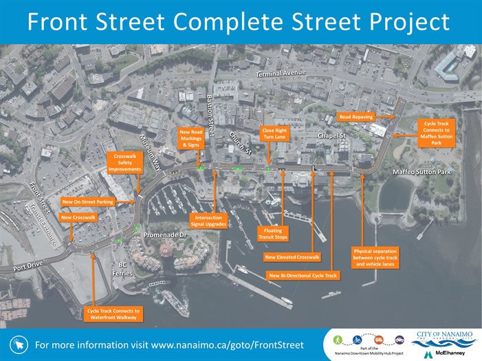
Front Street Complete Street Project
The Front Street Complete Street Project aims to increase the safety and comfort for people who walk, bike, take transit, and drive along one of Nanaimo's key downtown road corridors.
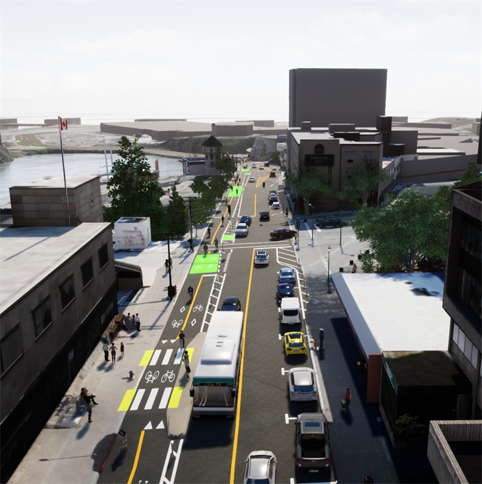
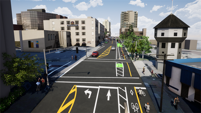
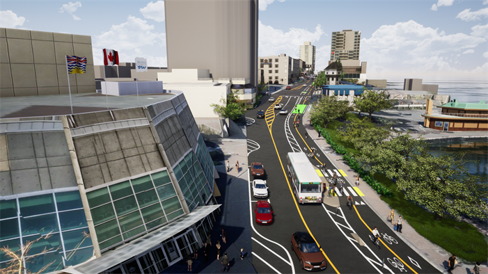
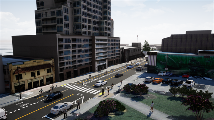
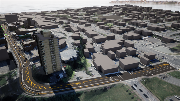
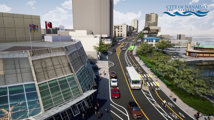 Concept rendering of project prepared by McElhanney
***Take notice that on October 22, 2021, a certificate of completion, or court order to that effect, was issued. See documents tab for more information.***
Some key components of the project include:
- Nanaimo's first two-way protected cycle track,
- New and improved transit stops,
- A new elevated crosswalk near the Nanaimo Law Courts,
- A new pedestrian crosswalk near the transit exchange,
- Reducing the number of vehicle travel lanes to two (one in each direction),
- Creating new on-street parking stalls
- Closing the right turn lane at the intersection of Church Street,
- New asphalt paving and road markings,
- Upgrades to electrical hardware at the signalized intersections, and
- Overall traffic calming, improved visibility and reduced speed limits.
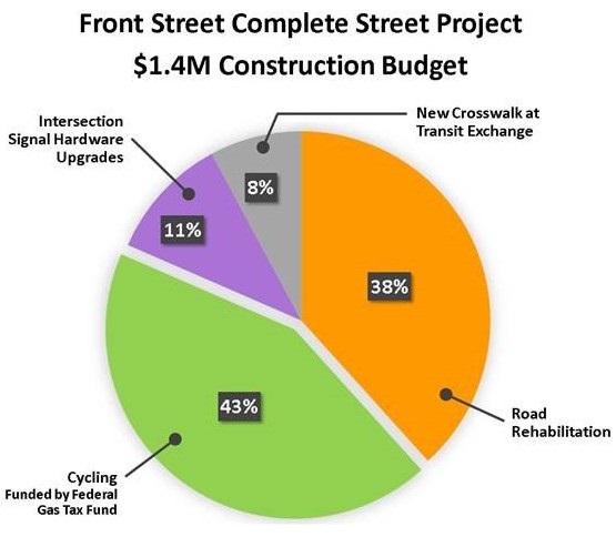
The Government of Canada contributed $605,000 to the project through the Federal Gas Tax program, which is administered in British Columbia by the Union of B.C. Municipalities.
The protected two-way cycle track is one of the short-term cycling priorities identified in the Nanaimo Downtown Mobility Hub Project, which will advance the vision of an integrated downtown transportation network that safely and comfortably accommodates pedestrians, cyclists, transit users, goods movement, and motorists.
Want to Know More?
Check out the project map and other additional information under the tabs below. Or contact:
- Kurtis Noble, Capital Project Management Specialist
- Email: kurtis.noble@nanaimo.ca Phone: (250) 756-5330
- Progress
The project is mostly completed and open for use by the public, including the new two way cycle track and transit stops. All users (pedestrians, cyclists, transit users and vehicles) are advised to use caution and watch for work crews and safety cones until all outstanding works are completed.
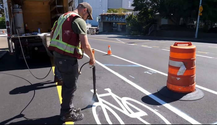
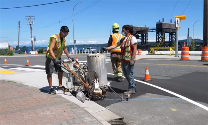
Outstanding works include completing new road markings, traffic signage, and finishing upgrades to the signalized intersections. Cyclists should dismount and use the crosswalks until the signal lights can be completed.
Delays with the project are in large part due to Covid-19 causing a shortage of several materials. For example, the Contractor is still awaiting delivery of some of the traffic signal light components and cannot complete the upgrades until they arrive.
We are hopeful to have everything completed by the end of September, and would like to thank everyone for their patience during the construction work.
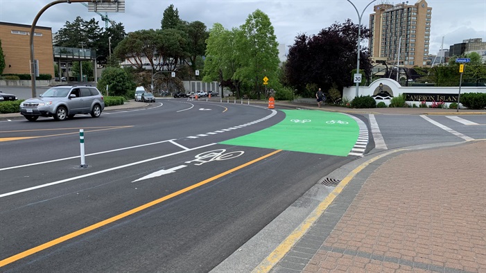
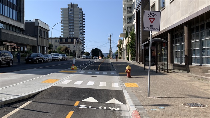
See below for a few photos from the construction.
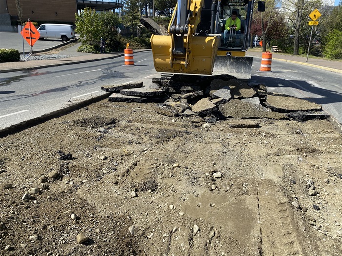
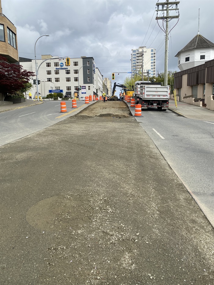
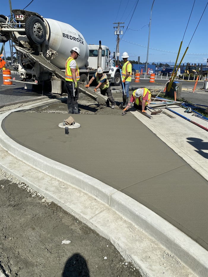
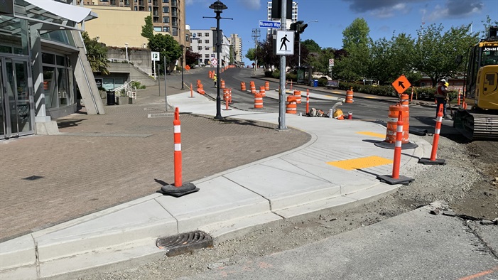
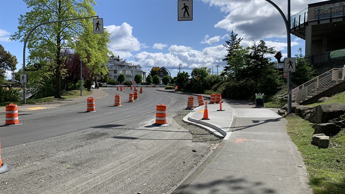
.tmb-full-width.jpg?Culture=en)
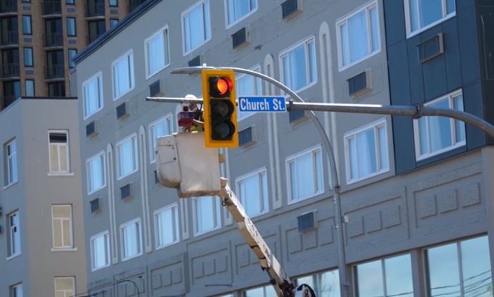
- Documents
- Details
Project Map
Click on the image below for a map that shows the preliminary details of the proposed improvements.
Frequently Asked Questions
Q1. What is the general cost breakdown for the project?
A1. See chart below. Costs rounded to nearest percent.
Q2. Why was the east (water) side selected for the cycle track?
A2. There were several factors in this decision:
Safety: There are fewer driveways and intersections on the east (water) side of Front Street, which offers reduced potential for conflicts between cyclists, motor vehicles, and pedestrians.
Connections: The east (water) side of Front Street offers easier and more direct connections to Maffeo Sutton Park, Pearson Bridge, the harbour wharf, and the Transit Exchange.
Parking: The smallest number of parking stalls are impacted as compared to either a cycle track on the west side or protected bicycle lanes on both sides.
Q3. How will parking be affected?
A3. Approximately 12 on-street parking spaces will be eliminated, mostly on the east side (water side) of Front Street between Chapel Street and Church Street. This change will be offset by the creation of approximately 26 additional on-street parking spaces in suitable locations on the west side of Front Street between Church Street and Port Place Centre, and on Museum Way.
Q4. How will transit be affected?
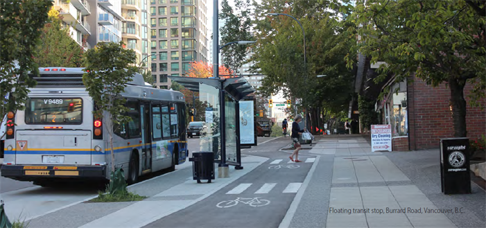
A4. Existing transit stop locations within the project area will generally be the same as they are today. Transit stops on the east side of Front Street that are adjacent to the new cycle track will include ‘floating bus stops’. In this design, the bus will stop at a raised concrete island, and the cycle lanes will detour behind the island and between the island and the pedestrian sidewalk. This design provides a protected space for cyclist to bypass both buses and passengers while they load and unload the bus. The crossing between the sidewalk and transit island will be the same elevation to allow for easy crossing for bus users and to slow down cyclists. The crossings will include walking surface indicators used to alert passengers, and particularly passengers with visual impairments, that they are approaching an area that is used by a different mode (ie the cyclists). Floating transit stops are the preferred treatment for transit stops along corridors with bicycle facilities according to the BC Active Transportation Guide. See example picture below.
Q5. What is a Mobility Hub?
A5. A mobility hub is a concentrated area of activity including employment, housing, recreation, and shopping interconnected with multimodal transportation options. Complete, compact communities focused around mobility hubs are more sustainable as they reduce reliance on personal vehicles. The 2014 Nanaimo Transportation Master Plan identifies seven mobility hubs in the City, including downtown.
Downtown Mobility Hub Project
The protected two-way cycle track is one of the short-term cycling priorities identified in the Nanaimo Downtown Mobility Hub Project. The Downtown Mobility Hub Project defined several short-term priorities that could be constructed in the next 5 years, which will advance the vision of an integrated downtown transportation network that safely and comfortably accommodates pedestrians, cyclists, transit users, goods movement, and motorists.
Learn more at www.nanaimo.ca/goto/DowntownMobility
Complete Streets
Complete Streets refers to transportation guidelines and a design approach that supports safe and comfortable travel for users of all ages and abilities, regardless of their mode of transportation.
Want to know more about Compete Streets and how the City of Nanaimo is working to develop our own Complete Streets Guidelines? Check out the project web page at www.nanaimo.ca/goto/CompleteStreets
Project Renderings
Concept renderings of the proposed improvements prepared by McElhanney
- Background
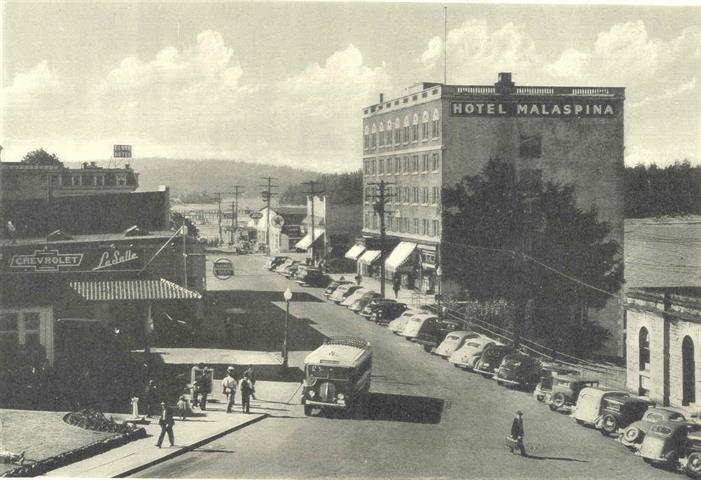
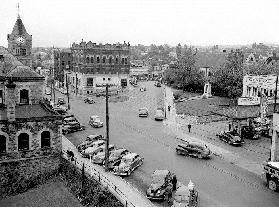
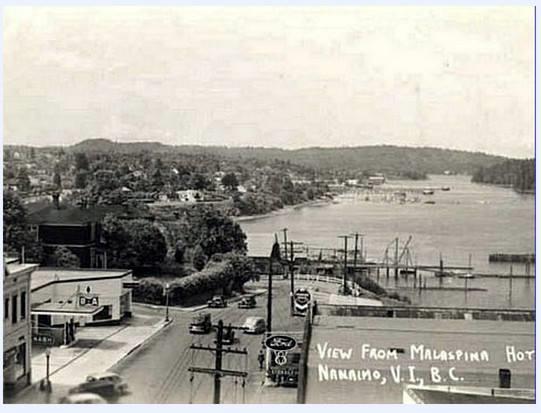
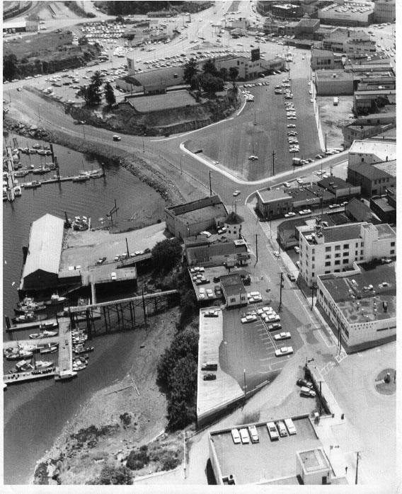
Some historical photos of Front Street courtesy of Nanaimo Community Archives.
Give feedback on accessibility. Submit your feedback through our online accessibility feedback form. Help us understand barriers people face when accessing City services.
You can attach files to help explain the barrier you faced in the form, like: a video, voice recording or photos. If American Sign Language (ASL) is the best way for you to communicate, upload a video of yourself using ASL into the form.
Please include: what you were trying to access, where the barrier happened, what the barrier was and any recommendations you might have.
Help us improve our website
Important Information About Privacy
Information collected on this form is done so under the general authority of the Community Charter and Freedom of Information and Privacy Protection Act (FOIPPA), and is protected in accordance with FOIPPA. Personal information will only be used by authorized staff to fulfill the purpose for which it was originally collected, or for a use consistent with that purpose.
For further information regarding the collection, use, or disclosure of personal information, please contact the Legislative Services Office at 250-755-4405 or at foi@nanaimo.ca


